Canada is the second largest country in the world. Only a few parts of the country are densely populated. More than half of Canada's population live in what is called the Quebec City-Windsor Corridor located in the southern parts of the two Central Canadian provinces:
 |
| The Quebec City-Windsor Corridor in North America |
Some statistics about this
Core Canada:
- Population:
19.2 million = 57% of Canada (more than the Netherlands, less than Romania—almost as much as New York State)
- Area:
265,000 km² = 102,300 sq mi = 3% of Canada (larger than the UK, smaller than New Zealand—almost as large as Oregon)
- Population Density:72 per km² = 185 per sq mi = 20 times as much as Canada (almost as densely populated as Bosnia-Herzegovina—like Indiana)
- Native Languages:
49% English, 32% French, 22% other languages
- MPs in the House of Commons 2015:
61% Liberals, 23% Conservatives, 11% NDP, 5% BQ
- MPs in the House of Commons 2011:
45% Conservatives, 41% NDP, 11% Liberals, 2% BQ
- MPs in the House of Commons 2008:
36% Conservatives, 31% Liberals, 25% BQ, 7% NDP
 |
| 1960s proposal for the national flag of Canada |
Two thirds of Core Canada's population live in Southern Ontario, one third in Southern Quebec. Both provinces have about the same area.
Southern Ontario:
- Population:
12.1 million = 94% of Ontario (more than Belgium—slightly more than Ohio)
- Area:
128,800 km² = 49,400 sq mi = 12% of Ontario (as large as Greece—slightly larger than Mississippi)
- Population Density:
94 per km² = 243 per sq mi = 7 times as much as Ontario (like Spain—between Illinois and California)
- Native Languages:
70% English, 4% French, 27% other languages
- Administrative Divisions:
22 counties 10 single-tier municipalities and 8 regional municipalities
- Largest cities:Toronto, Ottawa, Mississauga, Hamilton, Brampton
 |
| Flag of Ontario |
Southern Quebec:
- Population:
7.1 million = 90% of Quebec (as many as Serbia—more than Washington)
- Area:
136,200 km² = 52,500 sq mi = 9% of Quebec (larger than Greece, smaller than Nepal—almost as large as Arkansas)
- Population Density:
52 per km² = 135 per sq mi = 9 times as much as in Quebec (like Tanzania and Eritrea—between Kentucky and New Hampshire)
- Native Languages:
77% French, 12% English, 14% other languages
- Administrative Divisions:11 administrative regions with a total of 60 regional county municipalities, 6 independent towns and 4 agglomerations
- Largest Cities:
Montreal, Quebec City, Laval, Gatineau, Longueuil
 |
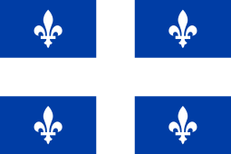
| Flag of Quebec |
Southern Ontario is a well established term. In this context, I define Southern Quebec as being Quebec without the sparsely populated administrative regions Bas-Saint-Laurent,
Saguenay–Lac-Saint-Jean, Abitibi-Témiscamingue, Côte-Nord,
Nord-du-Québec and Gaspésie–Îles-de-la-Madeleine and without the sparsely populated Agglomeration of La Tuque in Mauricie.
To compare with Europe, I have moved Core Canada to the east on the following map:
 |
| Der Umriss des Québec-Windsor-Korridors in Europa |


No comments:
Post a Comment